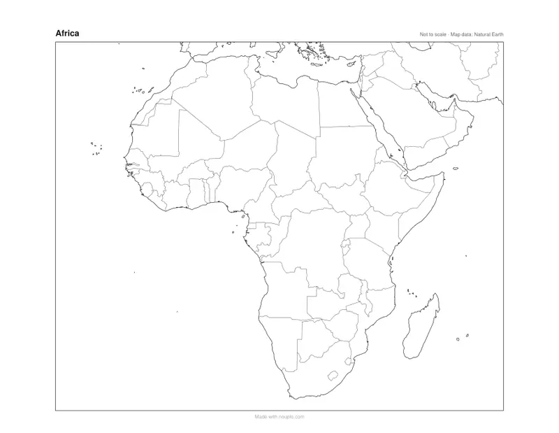
Printable blank map of Africa
All of Africa’s countries, outlined for learning.
Examples temporarily replace the input and settings. You can restore your previous work.
Pro keeps the settings you use every week and puts them one click away. See Pro
Free PDFs end with a small “Made with nouplo.com” line Remove limits with Pro
Save to PinterestYour files stay on your device
This tool runs entirely in your browser. Nothing is uploaded, nothing is stored, and you can even turn off your internet connection before you start.
Example
Africa for a class: all 54 countries named on one Letter sheet, 54 on the quiz
A sixth-grade teacher wants a labeled map of Africa for the wall and a blank one for Friday’s test. With “With country names”, every one of the 54 countries is named: inside it where the name fits, beside it on a thin leader line where it does not.
| Style and print size | What the sheet shows |
|---|---|
| With country names, 1 sheet US Letter | All 54; 15 small ones on a leader line: Gambia, Guinea-Bissau, Togo, Rwanda, Burundi, Malawi, Lesotho, Eswatini, Djibouti and the island states |
| With country names, 1 sheet A4 | All 54; Liberia goes on a line too (16) |
| With country names, 1 sheet A3 | All 54; 14 on a line (Malawi fits inside) |
| With country names, 4 Letter sheets (2 × 2) | All 54, plus Western Sahara; 11 on a line |
| With country names, 9 Letter sheets (3 × 3) | All 54, plus Western Sahara; 8 on a line: Gambia, Djibouti, Eswatini and five island states |
| Countries numbered, 1 Letter sheet + answers | 54 numbers, 1 Morocco to 54 Eswatini |
| Capitals numbered, 1 Letter sheet + answers | 54 capitals, 1 Rabat to 54 Maputo |
For the wall, one Letter sheet already names every country; for the test, the numbered worksheet asks all 54, Mauritius and the Seychelles included, with the answer key on page 2. The names map also names the countries at the edge of the frame, such as Spain, Saudi Arabia and Yemen.
How it works
- Pick a style: blank with borders for a quiz, coastline only for drawing, or with country names in your language.
- Choose the paper — A3 gives room to more names.
- Press Make PDF and print; the lines are vector, so they stay sharp at any size.
Frequently asked questions
- What can I use it for?
- Learning the countries of Africa, a map quiz, a project on a country, or showing the regions, languages or climates of the continent.
- Are the small countries named too?
- Yes. Every independent country of Africa is named, even on one A4 or Letter sheet: inside it where the name fits, beside it on a thin leader line where it does not (Gambia, Rwanda, Comoros, Mauritius, Seychelles). On A3 or several sheets fewer need a line.
- Is the map up to date?
- It is drawn from Natural Earth, a free public-domain map dataset that follows the borders as they are in practice. It is a map to learn and colour, not to measure distances.
- Can I get the whole world?
- Yes — the blank world map page draws the world and every other continent.
- Is there a map of Africa without country borders?
- Yes: choose “Coastline only (no borders)”. It prints the outline of the continent with Madagascar and no lines inside — for drawing the Sahara, the Nile or the regions yourself, or for a test where students draw the borders.
- Why does it say Congo-Kinshasa and Côte d’Ivoire?
- The names are the short country names of the Unicode locale data: Congo-Kinshasa is the Democratic Republic of the Congo, Congo-Brazzaville the Republic of the Congo. To colour countries you can type either form — “DR Congo”, “Ivory Coast” and “Swaziland” are recognised as well.
- Is anything uploaded?
- No. The PDF is made in your browser.
Made for a specific use
- Blank map of Europe
- Blank map of Asia
- Blank map of North America
- Blank map of South America
- Map of Europe with capitals
- Map of Africa with capitals
- Map of South America with capitals
- Map of Asia with capitals
- Capitals map worksheet
- World map with latitude and longitude
- Large printable world map
- Blank map of Oceania
- Blank map of the Middle East
- Blank map of Central America and the Caribbean
- Map of the Middle East with capitals
- Map of Central America and the Caribbean with capitals