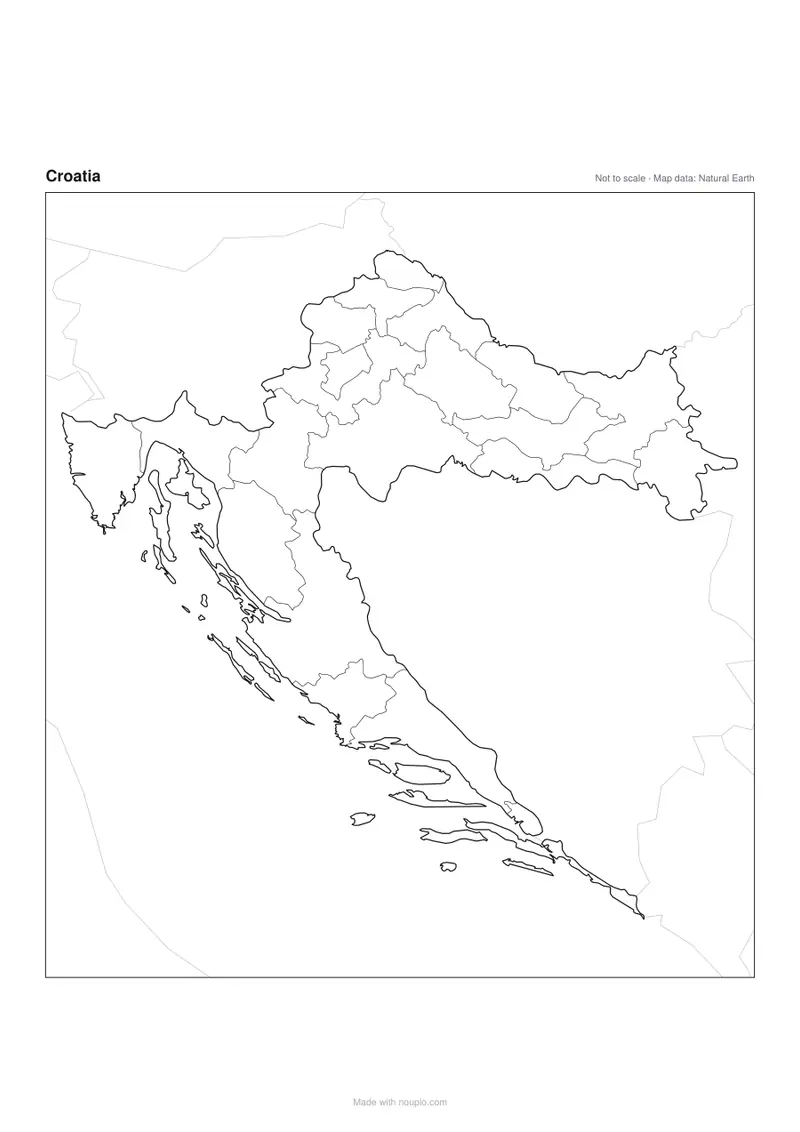
Printable blank map of Croatia
Croatia, by 20 counties and Zagreb, ready to label.
Examples temporarily replace the input and settings. You can restore your previous work.
Pro keeps the settings you use every week and puts them one click away. See Pro
Free PDFs end with a small “Made with nouplo.com” line Remove limits with Pro
Save to PinterestYour files stay on your device
This tool runs entirely in your browser. Nothing is uploaded, nothing is stored, and you can even turn off your internet connection before you start.
Example
Croatia’s 20 counties and Zagreb on A4: names, one leader line, numbered worksheet
A teacher at an international school in Split makes a sheet for new pupils. On A4 Croatia stands upright (210 × 297 mm). “With the names” fits 20 of the 21 names inside: Dubrovnik-Neretva, beyond Neum, is named on a short leader line, on A4, Letter and A3 alike. The four smallest, Krapina-Zagorje, Varaždin, Međimurje and the City of Zagreb, are set in 1.5 mm type.
- “Numbered, to write the names” numbers the 21 from 1 City of Zagreb to 21 Dubrovnik-Neretva on page 1, with a line for each, and lists the answers on page 2.
- With “Mark the capitals” there are 20 dots: Zagreb County has none of its own, as it is run from Zagreb, which is ringed as the national capital.
| No. | County | Seat | No. | County | Seat |
|---|---|---|---|---|---|
| 1 | City of Zagreb | Zagreb | 12 | Lika-Senj | Gospić |
| 2 | Krapina-Zagorje | Krapina | 13 | Karlovac | Karlovac |
| 3 | Zagreb County | Zagreb | 14 | Sisak-Moslavina | Sisak |
| 4 | Varaždin | Varaždin | 15 | Brod-Posavina | Slavonski Brod |
| 5 | Međimurje | Čakovec | 16 | Požega-Slavonia | Požega |
| 6 | Koprivnica-Križevci | Koprivnica | 17 | Vukovar-Syrmia | Vukovar |
| 7 | Bjelovar-Bilogora | Bjelovar | 18 | Zadar | Zadar |
| 8 | Virovitica-Podravina | Virovitica | 19 | Šibenik-Knin | Šibenik |
| 9 | Osijek-Baranja | Osijek | 20 | Split-Dalmatia | Split |
| 10 | Istria | Pazin | 21 | Dubrovnik-Neretva | Dubrovnik |
| 11 | Primorje-Gorski Kotar | Rijeka |
The seats pupils miss are the ones not in the county’s name: Pazin for Istria (not Pula), Rijeka for Primorje-Gorski Kotar, Gospić for Lika-Senj, Čakovec for Međimurje. The capitals worksheet asks exactly these, with Zagreb as the answer twice.
How it works
- Pick a style: blank with the borders for a quiz, the outline only for drawing, or with the names.
- Tick “Mark the capitals” to add a dot for each capital, and choose the paper.
- Press Make PDF and print; the lines are vector, so they stay sharp at any size.
Frequently asked questions
- Why is Dubrovnik apart?
- As on the ground: the southern tip, around Dubrovnik, lies beyond the short coast of Bosnia and Herzegovina at Neum, and the map draws it so.
- How are the counties named?
- As maps name them, after their seats and lands: Split-Dalmatia, Osijek-Baranja, Primorje-Gorski Kotar.
- Can I mark the capitals?
- Yes — a dot for each county seat, such as Split, Rijeka and Osijek, with Zagreb ringed. Zagreb County is run from the city and has no dot of its own.
- Is there a Croatia counties worksheet?
- Yes: “Numbered, to write the names” numbers the 20 counties and the City of Zagreb on page 1 with a line for each, and page 2 has the answers. The capitals version adds a Seat column.
- Is anything uploaded?
- No. The map is made in your browser. On the free plan a small line with our name is printed at the foot of the sheet.
Made for a specific use
- Blank US map
- Blank map of Canada
- Blank map of Mexico
- Blank map of Brazil
- Blank map of Germany
- Blank map of France
- Blank map of Spain
- Blank map of Italy
- Blank map of Turkey
- Blank map of Japan
- Blank map of South Korea
- Blank map of India
- Canada Map with Provinces and Capitals
- Australia Map with States and Capitals
- Map of Peru with Departments and Capitals
- Map of Chile with Regions and Capitals
- Map of Venezuela with States and Capitals
- Map of Ecuador with Provinces and Capitals
- Map of Bolivia with Departments and Capitals
- Map of Guatemala with Departments and Capitals
- Map of Portugal with Districts and Capitals
- Philippines Map with Regions and Capitals
- Map of Nigeria with States and Capitals
- Map of South Africa with Provinces and Capitals
- India Map with States and Capitals
- Canada Provinces and Capitals Worksheet
- Australia States and Capitals Worksheet
- Nigeria States and Capitals Worksheet
- India States and Capitals Worksheet
- US Map with States and Capitals
- Map of Mexico with States and Capitals
- Map of Brazil with States and Capitals
- Map of Spain with Provinces and Capitals
- Map of Italy with Regions and Capitals
- Map of France with Regions and Capitals
- Map of Germany with States and Capitals
- Map of Japan with Prefectures and Capitals
- Map of Colombia with Departments and Capitals
- Map of Argentina with Provinces and Capitals
- US States and Capitals Worksheet
- Mexico States and Capitals Worksheet
- Brazil States and Capitals Worksheet
- Blank map of the Philippines
- Blank map of Nigeria
- Blank map of South Africa
- Blank map of New Zealand
- Blank map of Ireland
- Blank map of Colombia
- Blank map of Argentina
- Blank map of Peru
- Blank map of Chile
- Blank map of Venezuela
- Blank map of Ecuador
- Blank map of Bolivia
- Blank map of Guatemala
- Blank map of Portugal
- Blank map of Belgium
- Blank map of Austria
- Blank map of Switzerland
- Blank map of Australia
- Blank map of Uruguay
- Blank map of Paraguay
- Blank map of Cuba
- Blank map of the Dominican Republic
- Blank map of Honduras
- Blank map of El Salvador
- Blank map of Nicaragua
- Blank map of Costa Rica
- Blank map of Panama
- Map of Uruguay with departments and capitals
- Map of Paraguay with departments and capitals
- Map of Cuba with provinces and capitals
- Map of the Dominican Republic with provinces and capitals
- Map of Honduras with departments and capitals
- Map of El Salvador with departments and capitals
- Map of Nicaragua with departments and capitals
- Map of Costa Rica with provinces and capitals
- Map of Panama with provinces and capitals
- Blank map of Sweden
- Blank map of Norway
- Blank map of Denmark
- Blank map of Finland
- Blank map of Czechia
- Blank map of Hungary
- Blank map of Romania
- Blank map of the UK
- Blank map of the Netherlands
- Blank map of Poland
- Blank map of Greece
- Blank map of Egypt
- Blank map of Indonesia
- Blank map of Pakistan
- Map of the United Kingdom with its capitals
- Map of Poland with voivodeships and capitals
- Map of the Netherlands with provinces and capitals
- Map of Indonesia with provinces and capitals